US strategic drone carries out reconnaissance over Donbas
On March 4, a US strategic RQ-4B unmanned aircraft made an almost ten-hour reconnaissance flight along the demarcation line in the Donbas, Interfax reported with reference to western aviation resources.
The drone spent hours flying along the demarcation line between the Ukrainian military and the uncontrolled territories, at an altitude of 16,000 meters. Afterwards the drone returned to the airbase in Italy.
On several occasions during the reconnaissance flight it flew within 40 km of Russia.
Based on its capabilities, the RQ-4A Global Hawk would have been able to observe all of the territories of the self-declared Luhansk and Donetsk People’s Republics (LPR and DPR), as well as a large area of territory in the neighboring provinces of Russia.
In addition, two US Air Force aircraft carried out reconnaissance flights close to the border of Russia’s Leningrad, Pskov and Kaliningrad provinces.
On March 2, a heavy RQ-4B Global Hawk flew for four hours along the Donbas demarcation line, after which it did reconnaissance along the south-western and southern coast of Crimea and the coast of Krasnodar Krai as far as Sochi.
Separatists previously tried to shoot down an OSCE drone 26 km from Donetsk.
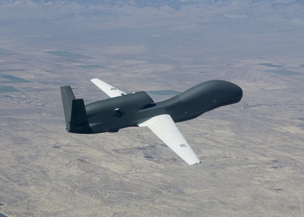
The RQ-4B Global Hawk is the largest reconnaissance drone in the world, with a high-resolution camera, infrared sensor and radar to track moving objects, and is designed to carry out strategic air reconnaissance up to 200 km into an enemy’s territory.
Since the start of 2018, the RQ-4B has been used repeatedly for reconnaissance close to the LDPR, Crimea, and Russia’s Black Sea coast.
It has also been repeatedly spotted flying close to the border of Russia’s Leningrad, Pskov and Kaliningrad provinces.